


Hurricane Laura kept growing into a massive Category 4 storm with 150 mph winds as it’s set to slam into the Gulf Coast overnight into Thursday with “catastrophic storm surge, extreme winds and flash flooding,” according to the National Hurricane Center.
The hurricane center warned Laura’s storm surge is capable of penetrating 40 miles inland from the Louisiana-Texas coast, as much as 20 feet high in some places.
As of midnight, the storm had maximum sustained winds accelerate to 150 mph, moving north-northwest at 15 mph and located 60 miles south of Lake Charles, La. and 65 miles southeast of Port Arthur, Texas.
Laura’s hurricane-force winds extend up to 60 miles from its center and its tropical-storm-force winds reach up to 205 miles.
The NHC said water levels had already begun to rise along the coast by early evening and as of 11 p.m., Cameron, Louisiana reported a sustained wind of 41 mph with a gust to 67 mph while Calcasieu Pass reported a sustained wind of 49 mph with a gust to 70 mph.
“Unsurvivable storm surge with large and destructive waves will cause catastrophic damage,” the NHC said. “The combination of a dangerous storm surge and the tide will cause normally dry areas near the coast to be flooded by rising waters moving inland from the shoreline.”

“Laura is expected to remain an extremely dangerous Category 4 hurricane through landfall tonight.,” forecasters said.
The 150 mph sustained winds is just shy of Category 5 status. The storm is expected to move over northwestern Louisiana on Thursday morning and into Arkansas Thursday night.
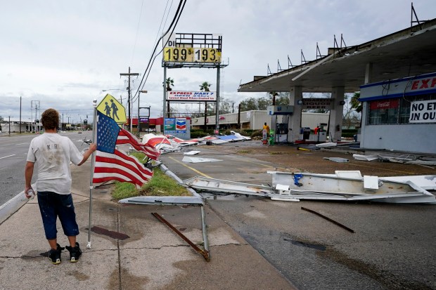
Rapid weakening should begin once it makes landfall, downgrading to Category 1 status Thursday afternoon with maximum sustained winds of 85 mph. But the initial impact to the Gulf Coast is predicted to be devastating, the NHC said.
“Some areas, when they wake up Thursday morning, they’re not going to believe what happened,” said Stacy Stewart, a senior hurricane specialist.
“We could see storm surge heights more than 15 feet in some areas,” Stewart said. “What doesn’t get blown down by the wind could easily get knocked down by the rising ocean waters pushing well inland.”
A number of watches and warnings were issued to Gulf Coast communities. First, a storm surge warning is in effect for Freeport, Texas to the Mouth of the Mississippi River. A hurricane warning was issued from San Luis Pass, Texas near Houston to Intracoastal City, La. A tropical storm warning is in effect from Sargent, Texas to San Luis Pass as well as East of Intracoastal City, La. to the Mouth of the Mississippi River. Lastly, a hurricane watch is in effect from East of Intracoastal City to Morgan City, La.
“This is shaping up to be just a tremendous storm,” Louisiana Gov. John Bel Edwards said on The Weather Channel Wednesday morning.
A Category 4 hurricane can cause damage so catastrophic that power outages may last for months in places, and wide areas could be uninhabitable for weeks or months. The threat of such devastation posed a new disaster-relief challenge for a government already straining to deal with the coronavirus pandemic.
“Heed the advice of your local authorities. If they tell you to go, go! Your life depends on it today,” said Joel Cline, tropical program coordinator at the National Weather Service. “It’s a serious day and you need to listen to them.”
People of Louisiana prepared for Laura by heading to stores to stock up on food, water and other supplies.
The area’s population still recalls the damage caused by Hurricane Katrina in 2005, when catastrophic flooding breached the levees in New Orleans and as many as 1,800 people died.
Gov. Edwards, who declared a state of emergency Friday, asked President Donald Trump for a federal emergency declaration.
In the largest U.S. evacuation of the pandemic, more than half a million people were ordered Tuesday to flee from an area of the Gulf Coast along the Texas-Louisiana state line, according to The Associated Press. More than 385,000 residents were told to evacuate the Texas cities of Beaumont, Galveston and Port Arthur. Another 200,000 were ordered to leave the low-lying Calcasieu and Cameron parishes in southwestern Louisiana, where forecasters said as much as 13 feet of storm surge topped by waves could submerge whole communities. On top of that, up to 15 inches of rain could fall in some spots in Louisiana, said National Weather Service meteorologist Donald Jones.
Laura also is expected to dump massive rainfall over a short period of time as it moves inland, causing widespread flash flooding in states far from the coast. Flash flood watches were issued for much of Arkansas, and forecasters said heavy rainfall could move to parts of Missouri, Tennessee and Kentucky late Friday and Saturday.
In Galveston and Port Arthur, Texas, mandatory evacuation orders went into effect at 6 a.m. Tuesday. People planning on entering official shelters were told to bring just one bag of personal belongings each, and “have a mask” to reduce the spread of the coronavirus.
“If you decide to stay, you’re staying on your own,” Port Arthur Mayor Thurman Bartie said.
Officials urged people to stay with relatives or in hotel rooms to avoid spreading the virus that causes COVID-19. Evacuation buses were stocked with protective equipment and disinfectant, and they would carry fewer passengers to keep people apart, Texas officials said.
Officials in Houston asked residents to prepare supplies in case they lose power for a few days or need to evacuate homes along the coast. Some in the area are still recovering from the devastation of Hurricane Harvey three years ago.
State emergencies were declared in Louisiana and Mississippi, and shelters opened with cots set farther apart, among other measures designed to curb infections. Shelters opened with cots set farther apart to curb coronavirus infections. Evacuees were told to bring a mask and just one bag of personal belongings each.
Laura’s unwelcome arrival comes just days before the Aug. 29 anniversary of Hurricane Katrina, which breached the levees in New Orleans, flattened much of the Mississippi coast and killed as many as 1,800 people in 2005. Hurricane Rita then struck southwest Louisiana that Sept. 24 as a Category 3 storm.
Laura is not expected to affect Florida, although it could bring rip currents along the Panhandle. Despite Laura not arriving on Florida shores, 40 Central Florida firefighters were activated as part of the Urban Search and Rescue Task Force 4 and set out for Louisiana at 8 a.m. Wednesday from Orlando. The team is led by firefighters from Orlando Fire Department, Orange County Fire Rescue and Seminole County Fire Department, as well as joined with members from Lake County Fire Rescue and Clermont Fire Department.
“Many of us were deployed after Harvey and Michael. We’ve seen devastation before. We’re ready for it,” said Task Force IV leader Walter Lewis. “We expect to have flooded areas, people stranded and in need of removal or rescue. We have boats, structural search gear and equipment for anything else to manage a challenge.”
Task Force IV will be deployed for 15 days, assisting with structural collapse, swift water rescue, wide area search and hazardous materials. The team has 15 trucks and four boats, and is made up of 40 firefighters including firefighters, paramedics, structural engineers, doctors, search and rescue K9s, and other highly-trained specialists. The team will arrive in Baton Rouge, Louisiana where the Louisiana State Fire Marshal will assume command.
The hurricane also threatens a center of the U.S. energy industry. The government said 84% of Gulf oil production and an estimated 61% of natural gas production were shut down, including Valero and Total refineries in Port Arthur, and Citgo’s plant in Lake Charles. Nearly 300 platforms have been evacuated. Consumers are unlikely to see big price hikes however, because the pandemic has decimated demand for fuel.
“If Laura moves further west toward Houston, there will be a much bigger gasoline supply problem,” Oil analyst Andrew Lipow said, since refineries usually take two to three weeks to resume full operations.
Laura caused the deaths of at least 11 people in the Dominican Republic and Haiti, while knocking out power and causing flooding in the two nations that share the island of Hispaniola.
Haitian civil protection officials said they had received reports a 10-year-old girl was killed when a tree fell on a home in the southern coastal town of Anse-a-Pitres, on the border with the Dominican Republic. Haiti’s prime minister said at least eight other people died and two were missing. In the Dominican Republic, relatives told reporters a collapsed wall killed a mother and her young son.
Hundreds of thousands were without power in the Dominican Republic amid heavy flooding in both countries.

Elsewhere in the tropics, the NHC expects a tropical wave moving off the west coast of Africa Wednesday night that has a slight chance of forming into the next tropical depression or tropical storm as it makes its way into the mid-Atlantic. The NHC gives it a 20% chance of formation in the next five days.
Staff writers Tiffini Theisen, David Harris, Katie Rice and The Associated Press contributed to this report.
More coverage at OrlandoSentinel.com/hurricane.