









After severe thunderstorms swept through the state Wednesday, and weather officials confirmed reports of 10 tornadoes over the next few days, Illinois has officially experienced at least 147 tornadoes so far this year — the most of any year on record.
Experts told the Tribune this pace is not normal: Illinois experienced an average of 54 tornadoes annually between 1990 and 2020. The most it has ever recorded in a year was 142 in 2024 — a record that, only halfway through 2026, the state has already shattered. Even in a busy 2024, only 91 tornadoes had hit the state as of June 22, according to NOAA data.

In 2023, Illinois recorded 121 tornadoes, followed by 142 in 2024 and 126 last year, according to federal data. Before this yearslong stretch, the state only had four years on record with over 100 tornadoes. The last time it saw triple-digit tallies was 2006.
“It’s a step change. It’s not even a trend,” said Trent Ford, the Illinois State Climatologist, in an earlier interview.
Preliminary data from the National Oceanic and Atmospheric Administration’s Storm Prediction Center shows Illinois leading the rankings across the country, head and shoulders above the traditional Tornado Alley areas of Iowa, Kansas, South Dakota, Nebraska, Oklahoma, Louisiana and Texas.
After a couple of days of respite, the state was once again being pelted with more severe weather Sunday. Northern Illinois had a “steady soaking” rainfall in the afternoon and evening with threats of localized flooding near and south of I-88. Meteorologists expect drier conditions for the beginning of the week, though a high swim risk will stay in place along Lake Michigan with the possibility of life-threatening currents and 4- to 7-foot waves.
“Then it looks relatively quiet, continuing into midweek. There’s another system that looks like it’s going to move into the region,” said Lee Carlaw, a senior meteorologist at the National Weather Service office in Chicago. “(Wednesday) will be the next chance for some scattered showers and possibly some thunderstorms, but at this point, no organized severe weather is expected with that activity.”
Carlaw said the agency has witnessed an active start to tornado season.
“That March (outbreak) definitely kind of set the stage for a really active stretch. We had several in April, and then obviously the ones that have continued here into June. So definitely an unusual, kind of hyperactive, fast start to the year.”
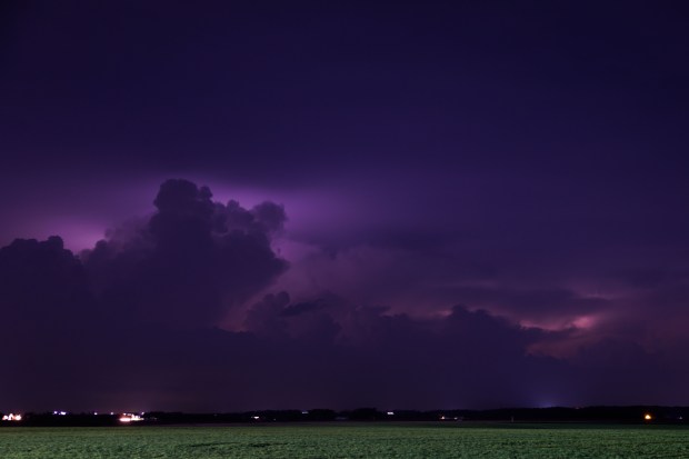
On Sunday afternoon, the weather service office in Lincoln issued a tornado watch for parts of east central and southeast Illinois through 9 p.m., shortly followed by a tornado warning for the villages of Stewardson and Strasburg in Shelby County and for Beecher City in Effingham County. Supercell thunderstorms in the region increased risks of large hail, damaging winds and a few tornadoes. Localized heavy rain was forecast to exceed 3 inches.
More tornado warnings were issued in the afternoon for communities across several counties. At least one tornado was confirmed by radar east of Louisville in southern Illinois.
Radar confirmed tornado east of Louisville in Clay County. Seek shelter indoors if you are in the path of this storm. Heads up Ingraham and Bogota! #ILwx pic.twitter.com/J1IgMh6t2j
— NWS Lincoln IL (@NWSLincolnIL) June 21, 2026
The weather service confirmed Thursday two tornadoes in central Illinois last week: an EF-2 in Charleston and Mattoon and an EF-0 in Pawnee Junction. The next day, they confirmed an EF-3 in Effingham.
EF-3 tornadoes are considered “severe” and characterized by speeds of 136 to 165 mph. EF-2 represents “significant” wind speeds of 111 to 135 mph, and EF-1 represents “moderate” speeds between 86 and 110 mph.
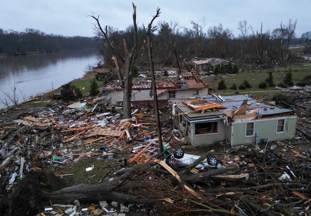
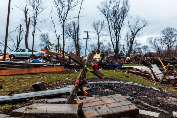
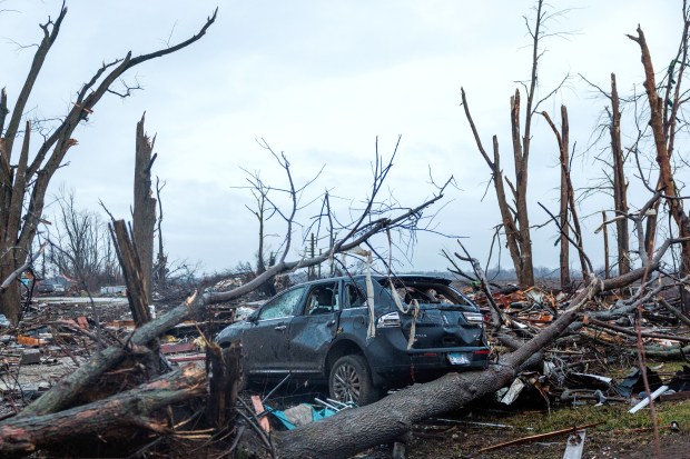
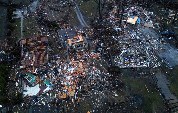
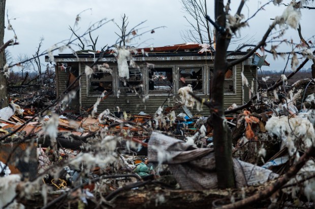
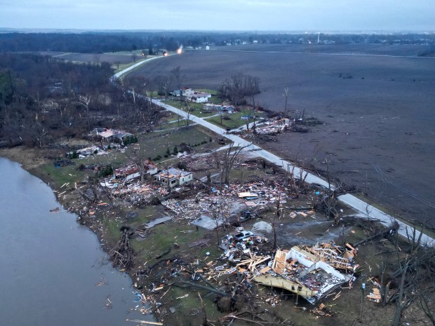
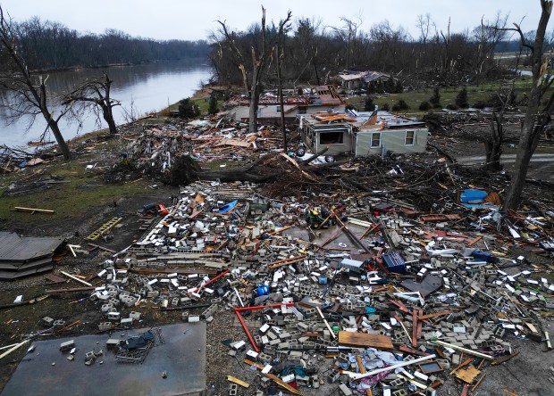
The Effingham tornado, which tracked almost 26 miles, ripped off several house roofs, even causing the “total” destruction of at least three single-family homes near Shumway and Teutopolis, according to the weather service. Hardwood and softwood tree trunks snapped approximately two-thirds of the way up. The force of peak winds within Effingham city limits threw a delivery van approximately 150 yards. Multiple non-life-threatening injuries were reported.
After another day of surveying, the central Illinois office confirmed Friday night four more tornadoes, all EF-1, in Springfield, Blue Mound, Bethany and Grove Township.
The Springfield tornado took an “eerily similar” path to that of a tornado just a week earlier, on June 10, according to the weather service. Both rated EF-1, passing near the Springfield Capital Airport and dissipating near Mechanicsburg. Both paths were 24.1 miles.
In the small town of Blue Mound, a tornado ripped parts of the local elementary school’s roof off and knocked down trees, one of which landed on the home of Bill and Susan Deetz.
“You could hear the wind and the roar at the same time, and I looked at Susan, and I said, ‘This is not good,’” Bill Deetz had told the Tribune as he stood in front of his home Thursday. “Then, all of a sudden, you heard this big crashing of the tree landing on the roof.”
Their home had several leaks, as well as a damaged roof and chimney.
The Chicago office has also confirmed an EF-0 tornado briefly touched down Wednesday near Grayslake at the Saddlebrook Farms subdivision at 9:32 p.m., with wind speeds of 80 mph, a width of 125 yards and a path length of ¼ mile. EF-0 tornadoes are considered “weak” with speeds between 65 and 85 mph, but they can still cause serious property damage. The weather service office in Quad Cities confirmed two tornadoes had occurred earlier in the day.
The Illinois numbers, especially this year’s, are baffling experts. For instance, 2024 was Iowa’s most frequent tornado year on record as well. This year, Iowa’s tally so far is 65, according to NOAA.
Right now, Ford said, there’s no explanation that would be completely satisfying for the spike in tornadoes in Illinois.
“If we say it’s just random weather variability, well, that can explain one crazy frequent tornado year, but not four in a row,” he said.
Climate change can also offer a partial explanation. As human activities such as fossil-fuel burning release heat-trapping gases into the atmosphere, air in the Midwest is becoming more saturated with humidity, a key ingredient of strong thunderstorms that can produce tornadoes.
“All the best evidence that we have today is that, if climate change is having an impact on tornadoes, it’s increasing frequency,” Ford said. And those analyses of increasing frequency in the Mid-South and Midwest account for better technology and reporting of tornadoes compared with when recordkeeping began.
Additionally, studies have shown tornadoes are happening more often during nontraditional tornado months, lasting longer and beginning sooner as winters become warmer and more humid. Most tornadoes in Illinois occur between April 1 and June 30, but according to the weather service, nearly half of the state’s tornadoes have occurred in the fall or winter in recent years.
However, climate change alone doesn’t seem to explain the sudden doubling of tornado numbers in Illinois over the last four years, or the state’s current count compared with others, especially given that planetary warming has been observed as a long-term trend since the mid-20th century.
“It’s not like, in 2022, climate change wasn’t happening,” Ford said. That year, Illinois only had 34 tornadoes.
Part of the explanation, Ford said, is that the right weather patterns have produced large tornado outbreaks in nontraditional tornado months, such as March of last year and July 2024.
“That makes the number go up really quickly,” he said, “but even that doesn’t explain everything, because we’ve had tornado outbreaks for as long as we’ve recorded tornadoes in Illinois.”
The La Niña climate pattern, which has been more dominant in the Midwest over recent years, does tend to bring on spring seasons with very active severe weather, Ford said. “We’ll see if that slows down next year, because of El Niño coming on.”
According to NOAA, La Niña causes the Pacific jet stream to move northward and to weaken over the eastern part of the ocean. During La Niña winters, the northern U.S. tends to be wetter and colder. On the other hand, El Niño causes the jet stream to move south and spread farther east. During winter, this leads to wetter conditions than usual in the South and warmer and drier conditions farther in the North.
Chicago Tribune’s Jack O’Connor contributed.


