


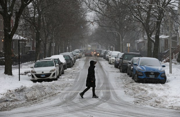


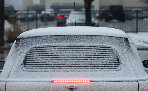


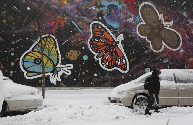


The first hit of a one-two winter punch started pummeling the Chicago area Thursday afternoon, as snow and a wintry mix began falling, with several days of bone-chilling, subzero temperatures forecast beginning overnight.
A winter weather advisory was in effect for the Chicago area through noon Friday.
A blast of arctic air will follow Thursday’s snow bands and likely continue into early next week, with the lowest temps expected this weekend and Monday.
The National Weather Service in Chicago predicts a low temperature of 2 below Friday night, with the high winds dropping the chill as low as minus 20, in addition to blowing the new snow.
Saturday evening, expect a low of minus 10 in the evening, with wind chills ranging from zero to 25 below. The predicted high temperature during the day is 17.
Sunday will be about as frigid as Saturday, with the mercury slowly creeping higher on Monday, when the predicted low is zero — though wind chills of minus 10 to 15 degrees are still expected.
According to Kevin Birk, a National Weather Service meteorologist, the average temperature for January was 5.4 degrees warmer than usual.
“Compared to what we had, it’s gonna feel pretty bad out there,” he said.
Heavy snowfall started raking the outlying Chicago area beginning about noon Thursday, according to the National Weather Service, and dumped about 1 to 3 inches on DeKalb and Rockford. Meanwhile, 2 to 5 inches were expected throughout the north and west suburbs with some slight dissipation as the storm moved into the city and northwest Indiana in the afternoon.
As of Thursday evening, the city said more than 200 plows and salt spreaders were dispatched across the city to clear main streets of accumulated flurries.
The far south suburbs were expecting about 2 to 4 inches of snow, which could fall at a “heavy clip” of up to an inch an hour during the afternoon, according to the weather service.
The snow was expected to be mixed with cold rain initially, creating icy conditions on roadways in some areas, the weather service cautioned. Strong winds, gusting at 40 mph or higher, were expected to blow the fresh snow, which came down on top of last weekend’s piles, creating dangerous conditions on area roadways during the evening commute and into early Friday morning. Hazardous road conditions were reported in eastern Iowa as the storm passed through.
Additional fluffy snow is possible over the weekend into Monday, the weather service said, which could add to the total accumulation. Birk said it was too early for a firm forecast, but that 1 to 3 inches of weekend accumulation Saturday and Sunday is possible.
Chicagoans who need a warm place to ride out the harsh conditions can use warming areas open from 9 a.m. to 5 p.m. on weekdays, city officials said Wednesday. Cook County also has warming centers in townships and municipalities throughout the area, but most are listed as closed on Saturday and Sunday, when temperatures are expected to be the lowest.
City and county officials caution residents not to use ovens or other cooking devices, such as grills, as a source of indoor heat as they are a carbon monoxide hazard. Exercise caution with space heaters and keep them away from any form of flammable material, ideally turning them off before going to bed, officials say. Residents should also consider dripping their faucets and bath fixtures to avoid pipes freezing.
Fire officials encourage people to check on their family members and friends who may struggle in freezing temperatures, especially those who are elderly or disabled.
Renters with heat issues can call 311 or visit the city’s CHI 311 website or app to file complaints. The city’s Buildings Department said it has made more than 3,800 heat inspections this season. Landlords are required to keep temperatures inside their units above 68 degrees during the day and 66 degrees at night, with a potential fine of $1,000 a day.
Check the Tribune’s weather page for updating forecast details.
charjohnson@chicagotribune.com

